eLanka
Friday, 17 Jul 2026
Home
Read History
Articles
eLanka Journalists
Events
Useful links
Obituaries
Seeking to Contact
eLanka Newsletters
Weekly Events and Advertisements
eLanka Testimonials
Sri Lanka Newspapers
Sri Lanka TV LIVE
Sri Lanka Radio
eLanka Recepies
Gallery
Contact
Newsletter
eLanka Weddings
Property
eLanka Shop
Business Directory
Search
Home
Read History
Articles
eLanka Journalists
Events
Useful links
Obituaries
Seeking to Contact
eLanka Newsletters
Weekly Events and Advertisements
eLanka Testimonials
Sri Lanka Newspapers
Sri Lanka TV LIVE
Sri Lanka Radio
eLanka Recepies
Gallery
Contact
Follow US
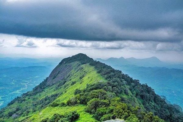
Alagalla Mountain Range
Articles
Arundathie Abeysinghe
May 6, 2022
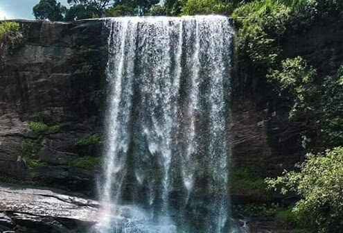
Meeyan Ella – spectacular waterfall with a history By Arundathie Abeysinghe
Articles
Arundathie Abeysinghe
April 9, 2022
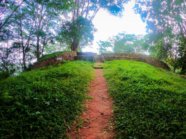
Balana Fort – strategic rock fortress in Kandyan hills By Arundathie Abeysinghe
Articles
Arundathie Abeysinghe
March 3, 2022
Alagalla Mountain Range – defense location of yesteryear By Arundathie Abeysinghe
Articles
Arundathie Abeysinghe
November 21, 2020
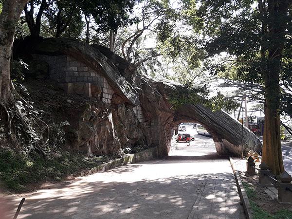
Kadugannawa Pass and Rock Tunnel – gateway to hill country By Arundathie Abeysinghe