Balana Fort – strategic rock fortress in Kandyan hills
By Arundathie Abeysinghe
 Situated between *Kadugannawa Pass and *Alagalla Mountain Range, Balana Fort was constructed during the *Kandyan Kingdom as a strategic rock fortress and an outpost for the Kingdom.
The mountain of Balana is located over 600 meters above sea level. At present, Balana is administered by the *Central Province and is also the boundary line between the *Sabaragamuwa and Central Provinces.
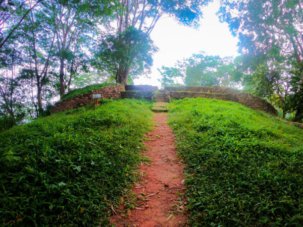
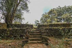
Balana Fort (Balana meaning Look-Out in Sinhala) was utilized as a sentry point on the approach to Kandy and was a strategic defense post to prevent enemy invasions and the remains of the Fort can still be found on the summit. According to historians, the path behind the Balana Railway Station has been the old road which is a steep 2.5 kilometer climb to the summit of the mountain and extends comparatively flat to the open plains towards Danture village. At present, the path is well-carpeted and there is a bus service from *Kadugannawa. Yet, approximately 300 years ago, it has been an arduous climb. Summit of Balana renders breathtaking vistas of the environs and plains below…
This fort has been the most significant pass during the Kandyan Kingdom with the other being at Galagedara (a village in the Central Province of Sri Lanka).
The majority of battles against invasions aimed at the Kandyan Kingdom by the western nations during the Colonial rule of maritime provinces of Sri Lanka occurred at the Alagalla Mountain range and invading foreign armies were defeated by battles at Balana Fort under the reign of Kandyan Kings.
According to historians, when the Portuguese landed in Sri Lanka in 1505, their objective was to acquire more territory. Yet, the Balana Rock Fort that served as an observation post stood against an invasion of the Kandyan Kingdom. During this period, the Portuguese were in control of the *Kingdoms of Kotte, Sitawaka and Jaffna. Yet, they were unsuccessful in their attempts to capture the Kingdom of Kandy in 1594, 1603 and 1630. Balanna ‘look out’ post was the main obstacle.
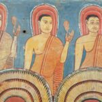
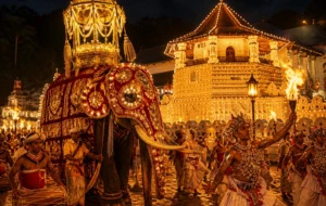
According to scholars, Balana Fort protected Buddhism and Sri Lankan culture from western powerful nations such as the Portuguese, Dutch and English for approximately five centuries.
According to *Major Roland James Milleville Raven-Hart, OBE in his work the “Great Road” (published by Royal Asiatic Society of Sri Lanka), the arduous climb up the pass was rewarded with the superb vistas of the “western horizon”.
During the British Colonial Era, colonizers constructed the Colombo-Kandy railway line through tunnels in the mountainous area and also planted tea and coffee in close proximity to the Colombo-Kandy railway line.
According to chronicles, the first mention of Balana is during the invasion of the Kandyan Kingdom (era of King Rajasinghe I of Sitawaka) in 1582. According to *Rajavaliya, King Karaliyadde Bandara, ruler of the hill country was defeated at Balana by King Rajasinghe followed by the subjugation of the Kandyan Kingdom under Sitawaka Kingdom.
At present, Balana Fort and its environs are neglected and overgrown with weeds. It is under the purview of the Department of Archaeology.
Directions: Travel up to Kadugannawa on Kandy – Colombo Road. Thereafter, travel approximately five kilometers on Poththapitiya Road near the Kadugannawa Railway Station and turn left to the road towards Balana (approximately three kilometers from the site). Hike approximately 500 meters from the road through a tea estate to reach Balana Fort.
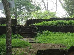
Image courtesy: archaeology.lk, storyoflanka.com and lakpura.com
- Alagalla – Alagalla Mountain Range also known as “Potato Mountain Range” and known as “Tuber Rock” in English is situated at an elevation of 1,140 meters. The Mountain Range is situated at the border of the Central and Sabaragamuwa Provinces. The highest point of the Mountain Range is Bible Rock.
- Central Province – Located in the central hills of Sri Lanka, the Province has three administrative districts; Kandy, Matale and Nuwara Eliya.
- Kadugannawa – Kadugannawa (about 106 kilometers from Colombo and about 15 kilometers from Kandy) is situated on Colombo – Kandy Road. Kadugannawa is considered as the gateway to the hill country and can be reached by vehicle and by train. A small town in Kandy District, it was the main access to Kandy during the Kandyan Kingdom. Several battles had taken place in this location before the British Colonial Era.
- Kingdom of Gampola – Gampola is a town situated in close proximity to Kandy in the Central Province of Sri Lanka. Gampola was established as the capital of Ceylon by King Buwanekabahu IV (from 1344 – 1345 and from 1353 – 1354) in the mid-14th century.
- Kingdom of Kandy – Founded in the late 15th century and endured until the early 19th century, Kingdom of Kandy was an independent monarchy in Ceylon (present Sri Lanka) and the last Sinhalese kingdom to be conquered by a colonial power. Kandy survived the attacks of Ceylon’s first two colonial rulers, the Portuguese and the Dutch and was finally conquered by the British, in 1818.
- Kingdom of Kotte – This was a kingdom which flourished in the 15th century in Ceylon. The term “Kotte” is believed to have derived from the Sinhalese word kotta and Tamil word kottei, meaning fortress. The word Kotte was introduced by Nissankamalla Alagakkonara, the founder of the fortress. According to legends, Kotte had been founded as a fortress by Minister Alakeswara (1370 -1385) of *Kingdom of Gampola.
- Major Roland James Milleville Raven-Hart – A lieutenant in the 10th Battalion of the Suffolk Regiment (1914-1927), part of the Special Reserve Brigade and appointed signal commander was promoted to the rank of Major. He was also attached to the Royal Engineers and the Egyptian Expeditionary Force.
- Rajavaliya – This is a 17th-century historical chronicle, covering the history of Sri Lanka from its legendary beginnings up to the accession of King Wimaladharmasuriya II in 1687. This is the only continuous history of Sri Lanka written in Sinhala Language prior to the British Colonial Era. Unlike many other Sri Lankan historical chronicles, Rajavaliya describes political aspects rather than religious (Buddhist) events. According to historians, the work has been written by many scholars, especially the period after 1359.
- Sabaragamuwa Province – One of the nine provinces of Sri Lanka located in the south-central region of the island.
Alagalla Mountain Range – defense location of yesteryear – By Arundathie Abeysinghe
Kadugannawa Pass and Rock Tunnel – gateway to hill country
By Arundathie Abeysinghe