Kadugannawa Pass and Rock Tunnel – gateway to hill country
By Arundathie Abeysinghe
 Kadugannawa Pass and Rock Tunnel are important landmarks on Colombo – Kandy Road. Kadugannawa is considered as the gateway to UNESCO World Heritage Site Kandy as well as Central Highlands. Highest point of the climb of Colombo – Kandy Road is known as Kadugannawa Pass, a lookout point of the Kandyan Kingdom to monitor invading foreign forces in the 16th and 17th centuries from the lowlands of Sri Lanka. Kadugannawa had been an outpost of the Kandyan Kingdom and many battles have taken place in this historic town in the past.
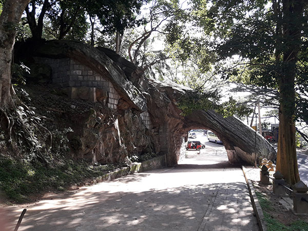
Known as Gala Vidapu Thena by locals (meaning the rock that was pierced in Sinhala), the Rock Tunnel had been a symbol of Colombo – Kandy road from time immemorial.

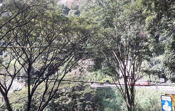
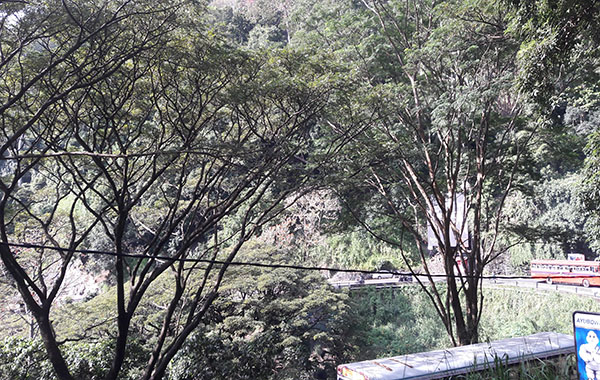
Kadugannawa Pass is situated between Kandy Valley and *Kegalle Valley and for centuries this pass has been the main access point to Kandy. Hence, invaders attempting to occupy Kandy had to bypass this point and futile battles have taken place here before British invaded Kandy. During futile attempts of foreign troupes attempting to invade Kandy, Sinhalese forces have successfully stopped such invasions with guerilla warfare at Kadugannawa.
Situated in Kandy District of Central Province, Kadugannawa Pass can be reached after passing many hairpin bends and sharp gradients. At the last and sharpest bend, the road forks and one road passes through a Rock Tunnel with a passage pierced into a cliff to form a tunnel wide enough for a bus or lorry to pass through it.
As there were no proper roads for wheeled carriages that transported agricultural produce from the hill country to reach the coastal areas of Sri Lanka, merchandise were conveyed using cattle (thawalama in Sinhala) in the past. As this was a difficult task, during the British Colonial Era, such obstacles were gradually removed by constructing a good road and railway network with the objective of transporting products.
Hence, in 1820s, during the British Colonial Era, British Governor Edward Barnes (1824 – 1831) wanted a new road constructed to reach Kandy from Colombo as the existing road to reach Kandy was long and circuitous via *Kelani River Valley to *Ruwanwella via*Ma Oya Valley along the incline to *Gampola to reach Kandy.
When constructing the new road to Kandy from Colombo, the British decided to perforate the rock at Kadugannawa Pass instead of blasting or bypassing it. The rock that was perforated is known as Kadugannawa Rock Tunnel and today it is preserved as a symbol.
According to folklore, the rock was pierced to fulfill a prophecy that there was no way for foreigners to rule Kandy unless they pierce mountains. Hence, the British had perforated the rock at Kadugannawa and created a rock tunnel when constructing the road from Colombo to Kandy. Kadugannawa Rock Tunnel carved through a rock in the mountain played a major role in fulfilling the prophecy.
Colombo – Kandy Road was widened and upgraded in late 1980s as modern large vehicles could not pass through the Rock Tunnel. Hence, the road used at present was constructed above the symbolic Rock Tunnel with a wider bend and without overhead encumbrances.
A popular stopover of local and foreign tourists traveling on Colombo – Kandy Road, Kadugannawa Pass offers great vistas and spectacular views of Bible Rock (Batalegala) and *Alagalla Mountain Ranges which astonish as well as inspire an onlooker with awed respect and delight.
The grandeur of the popular viewpoint entices a traveler to take a few photos of the spectacular environs and the valley below with corn on the cob or while sipping a king coconut. At present, there is a car park next to the Rock Tunnel with a few benches and tables, a popular stopover of those travelling to Kandy.
Kadugannawa Pass and Rock Tunnel showcase Captain Dawson’s (Captain William Francis Dawson popular as Captain Dawson) technical expertise and marvelous engineering skills.

- Alagalla Mountain Range – Situated at the boundaries of *Central and *Sabaragamuwa Provinces.
- Central Province – Located in the central hills of Sri Lanka, the Province has three administrative districts; Kandy, Matale and Nuwara Eliya.
- Gampola – A town in Kandy District, Gampola was the capital of Sri Lanka during the reign of King Buwanekabahu I in the mid 14th
- Kegalle – Kegalle (known as Kegalla in Sinhala) is a large town in west-central Sri Lanka located on Colombo – Kandy Road, approximately 78 kilometers from Colombo and 40 kilometers from Kandy. Kegalle is the main town in Kegalle District.
- Kelani River – One of the major rivers in Sri Lanka and is 145 kilometers long.
- Ma Oya – The watershed of Ma Oya (Oya meaning stream in Sinhala) flows through four districts: Kegalle, Kurunegala (capital city of North Western Province), Gampaha (situated north east of Colombo in the Western Province) and Puttlam (large town in Puttlam District of North Western Province) of Sri Lanka.
- Ruwanwella – A Divisional Secretariat of Kegalle District.
- Sabaragamuwa Province – Located in the south-central region of Sri Lanka and comprises Ratnapura and Kegalle Districts.


