Rangala Natural Pool amidst spectacular landscape – By Arundathie Abeysinghe

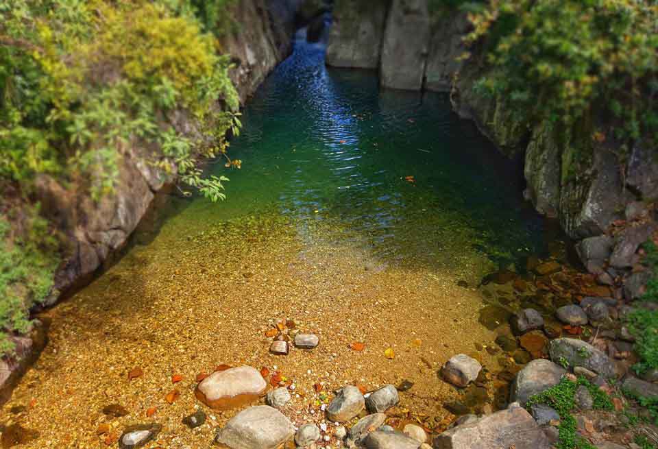
 Situated in *Teldeniya in Kandy District, Rangala Natural Pool is situated amidst tea estates, fields, mountains and beautiful streams. It is an alluring natural pool. Rangala village is a spectacular hamlet and the pool can be easily accessed. Considered as one of the best natural pools in the *Knuckles area, some visitors have named the pool as a “theatrical pool” due to its shape.
The river that flows through Rangala is the origin of this natural swimming pool. The deepest end of the pool is approximately nine meters (30 feet). Yet, there is one section of the pool which is over nine meters (30 feet) deep. It is not advisable to bathe in that area.
There is a small bridge to indicate the location of the pool (over Kotaganga (“ganga” meaning river in Sinhala) that originates from Knuckles Mountain Range. Crystal clear water flows through two boulders creating this spectacular pool and the bottom of the pool is covered in pebbles with only few inches of water on the side closer to the Bridge, a mesmerizing sight similar to a man-made pool…
Water to the pool flows from a waterfall located at the far end of the pool. There are also several small natural pools created due to rocks and boulders along the streams originating from Kotaganga. There is a footpath to reach these pools too.
Directions: From Kandy travel approximately 45 kilometers along Kandy – Katugastota road towards East Teldeniya. Rangala is situated approximately 15 kilometers from Teldeniya.
Caution: The flow of water can change rapidly depending on the rainfall in the catchment areas. In 2017, four deaths were reported on social media.
“Take only memories, leave only footprints.” – Chief Seattle
- Knuckles Mountain Range – Located in Kandy and *Matale Districts at a height of approximately 914 meters above sea level with a land area of around 21 hectares, Knuckles Mountain Range has a total of 35 peaks which rise above 900 meters. British Surveyors called this Mountain Range Knuckles Mountain Range as the Range is similar to a clenched fist.
- Matale – Located at the heart of the Central Hills, Matale is situated at an elevation around 365 meters above sea level. Matale is the administrative capital of Matale District of Central Province.
- Teldeniya – Situated approximately 20 kilometers from Kandy was submerged during the construction of the *Victoria Dam.
- Victoria Dam – Located in Teldeniya, Victoria Dam is an arch dam is named in honor of Queen Victoria, former Empress of the British Empire. Its main purposes are irrigation and hydroelectric power production. Victoria dam is a concrete structure with a double curving arch. The United Kingdom provided funds for the construction of the Dam. It was declared open on April 14, 1985. The journey to the dam is approximately an hour from Kandy City.
Teldeniya – location of “Indiana Jones and the Temple of Doom” – By Arundathie Abeysinghe
September 22, 2022