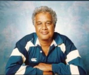
Roman Szechowycz: A Discerning Eye for Past & Present in the Gal Oya’s History-by Michael Roberts

Source:Thuppahis
This is a presentation of an article entitled “The “Rock River” Story” by Roman W. Szechowycz in the Loris Magazine, Vol. 8 No. 6 December, 1960. Page 348. Its presentation here has been made feasible by my Aloysian pal KK De Silva. I have underlined aspects of this account with highlights.
Let me stress here that Roman Szechowycz’s searching eye and mind leaves me amazed. This essay links the landscape to its medieval and ancient history and dwells on the history of Sinhalese civilization in revealing manner.
ROMAN’s ARTICLE : The “Rock River” Story
The Gal Oya river is full of interesting historical associations and if the river could talk, the story told by her would be worthy of record. In recent times the name of Gal Oya has become the symbol of the new Lanka, a symbol of new spirit with the endeavour to obtain not only complete political but economic independence as well. The new development scheme derives its name from the river, which since 1951 (in which year she was tamed by a dam built at Inginiyagala) is forced to perform full time work for the country.
Gal Oya starts in the Uva Hills at a 4,000 feet elevation, and flows down rapidly. The first historical mark is found 7 miles from the source on the right bank of the river at the point where the road from Lunugala crosses it. There is a white square monument, a memorial to Sylvester Wilson, the first representative of the British Government in Uva who was killed on this spot by an arrow on 16th September, 1817, the first casualty in the riots which started in the Gal Oya Valley against British rule by the pretender to the Kandyan throne, an ex-priest who assumed the title of King Doraisamy.
Close to Bibile, the river enters the Nilgala plains. This part of the Valley is covered with beautiful savannah (damana) forest and is the home of elephants and other wild life. In 1857 the Governor of Ceylon, Sir Henry Ward, inspected this part of the Island crossing it by foot from Bibile to the coast along the course of the Gal Oya. He described the scenery as follows:
“All that Nature can do, to make a country attractive, by most beautiful combination of mountains, forests, rivers, fertile valleys and rich grazing grounds upon the hills, is to be found, scattered, with profuse hand, over this space of about 70 miles which comprises a portion of which is called the Park” .
The river having grown bigger with several tributaries, passes the abandoned Nilgala village where at present a small circuit bungalow built for the benefit of the visiting officers exists.
Close to this place many ruins bear witness of the splendid past. According to tradition, the pretender to the throne, Doraisamy, organized his followers in this place. Below Nilgala, the river bed becomes very rocky forcing its way through a small range of hills. One has to se¢ this part of the country to understand why this stream is called Gal Oya (Gal—rock; Oya—river’).
Thirty-three miles from its source it flows into the newly constructed Senanayaka Samudra reservoir at a point where the ruins of an ancient fort are found. This fort was established by the British army in 1817 to secure communication with Batticaloa from where a detachment of soldiers was sent to Kotabowa, a village close to Bibile, to quell the disturbances and maintain peace. One of the soldiers (Galladine) maintained a diary and the crossing of the Gal Oya which took place on 30th October, 1817, is described as follows:
“….. next Pattipola Aar was reached. This the men crossed with bundles on their heads, but to transport the stores which 300 bullocks carried was not an easy matter. A rope was secured at some height above the water and fastened to trees on the bank, and on this the bags were slung and hauled across by a second rope, a task which occupied many hours.
‘The Sinhalese were watching unseen and occasional arrows kept the soldiers alert. Wild life was abundant, herds of elephants and deer passed by and myriads of leeches which appeared from all directions proved a terrible pest ……”
Pattipola Aar is the Tamil name given to the lower segment of the Gal Oya river. The river was faithful to her country and so were the leeches. The Military post at Makarai was, however, not kept for a long time and was soon abandoned. The diarist records:
“… . due to violent outbreak of sickness which first showing itself towards the end of July at the post of Pattipola Aar on the banks of the river, soon spread to Kotabowa, where in the two weeks the garrison was prostrate. Nine Europeans were buried in the last week of August, but while they and Malays proved very susceptible to infection, the Caffrees remained immune……”
A further 4 miles east, now covered by the reservoir, there existed hot water springs. A big cave with stone wall partitions exists about 2 miles north from the edge of the water spread near this point. According to local belief Sinhalese queens found refuge in this cave when the enemy invaded the country. On such occasions the kings entrusted their wives to the Veddas who were faithful to the throne. Until today a few Vedda families have survived civilization and are living in this part of the Valley.
Not long ago Tissahamy the Vedda outlaw found refuge in this area and evaded the police for 15 years.
Further downstream the majestic Westminster Abbey rock called in Sinhalese (Govinda Hela) overlooks the Valley from the south. King Buwaneka Bahu I (1271-1284) ruled the country having built a fortress on this rock in 13th century A.D. The Mahavamsa, chapter 81, records: “Buwanekabahu, ruler and governor of the land, whose fame has spread throughout the country, also built himself a fortress on the top of Govinda, a rock which enemy could not easily approach, and he dwelt there and defended the Ruhuna country and its religion and its priesthood.”
On the top of Westminster Abbey can be seen the ruins of a castle, pokunas and walls. The scattered ruins in the Gal Oya Valley in the vicinity of this rock at Wadinagala, Dambadeniya and Perawatta provide indisputable proof that this area was densely populated at a certain period of history. The dam across Gal Oya is built 43 miles from the source at the foot of the Inginiyagala rock, which rock has become the emblem of the present development scheme and is immortalized in the Ceylon two rupees stamp. According to local village tradition which however differs from the story recorded in the Mahawamsa, the unhappy queen Kuveni is reported to have committed suicide by jumping from this rock having been abandoned by Wijaya, the founder of the Sinhalese race. Below the Senanayake Samudra reservoir, Gal Oya takes several tributaries of which Namal Oya, Pallang Oya and Ekgal Aru are the most important. The river touches the Amparai Kondawattuyana and Irrakkamam tanks which most probably originated at the time of King Dutugemunu and his brother Tissa in the 2nd century B.C
A report of these tanks written in 1857 reads:
“….I need not point out the immense advantage of the previous work, for which we have simply to restore what actually existed.”
The restoration of the Irrakkamam Tank was -completed in 1859, and the restoration of Amparai tank in 1860,
A few miles north-west of Amparai tank is. situated the abandoned Digavapi (long tank) where in the 2nd century B.C. the capital of the Sinhalese Kingdom was established. It was here that the Sacred “King’s Regalia” and royal elephant were safeguarded. In 1953 during the present development, a pillar with inscriptions dated as the 10th year of King Dappula IV (924—935 A.D.). was discovered.
This appears to confirm the local tradition that this part of the valley belonged to Digavapi Mandala which was handed over to Saddhatissa by his brother, King Dutugemunu to raise the necessary food to fight King Elara.
Before entering into the sea the river flows close to the ancient Digavapi Vihara which according to tradition was one of the places visited by Lord Buddha. In this connection it is worthy to mention that local tradition claims that at first the Wadinagala rock was visited by Lord Buddha and when He disliked this place Digavapi was selected by him as a place of meditation.


