Sinharaja world heritage-By Professor Emeritus Nimal Gunatilleke
Source:Island
Conservation Outlook Assessment: Significant Concern
Continued from Yesterday
Water diverted from Ampanagala reservoir to Muruthawela will be used to meet the irrigation deficit of Muruthawela and Kirama Oya systems and the balance will be transferred to Chandrika Wewa, through existing LB canal of Muruthawela scheme up to 13.8 km and a new canal of 17.0 km. After that, the water requirement of Hambantota harbour is to be transferred to Ridiyagama tank through the Walawe river and Liyangasthota anicuit. However, due to the extreme length of the diversion through the three-river basins of Nilwala, Kirama Ara and Urubokka Oya, it will lead to a massive conveyance losses of the diverted water while on the way to the Walawe basin. Furthermore, enormous costs associated with its construction, a failure to fully realise the intended outcomes due to a shortage of water budget will simply be a burden that Sri Lanka cannot afford with her current economic condition, according to Eng. Prema Hettiarachchi. It may be worth recording that the water ingress into the grouted tunnel of the Uma Oya near Ella has still not been fully repaired, even though the Uma Oya project is nearing completion. An expensive lesson to be learnt on the nature of the weathered geological structure, lineaments and implementing its unexpected and costly mitigatory measures which will eventually to be paid back by this and future generations of tax payers of this country.
According to the Irrigation Department web site postings, Mahaweli Consultancy Bureau has initiated the Environment Impact Assessment (EIA), but due to the unavailability of concurrence of the Forest Department, revised TOR has not been issued by the CEA. Therefore, due to the unavailability of updated TOR, the EIA study has been delayed.
Environmentally, the most contentious issue highlighted in the news media is the proposed construction of a RCC dam at Madugeta to build a reservoir for which around 79 ha of forested (and some agricultural) lands in Sinharaja and a portion of prisine riverine forest in Dellawa would be inundated. On the Sinharaja side of the proposed Madugeta reservoir (right abutment) at present there are home gardens and small-scale tea plantations in addition to good riverine forests. In contrast however, proportionately a larger area of luxuriant forest of Dellawa, which is a part of the new ‘Sinharaja Rain Forest Complex’ would go under the chain saw for this reservoir construction (left abutment). The Geo-engineering report of May 2019 on GNDP has revised the siting of the dam to a more favourable location with supposedly reduced impacts but they forewarn that the three core-drilling along the proposed dam axis that had to be temporarily abandoned due to protests made by the villagers, need to be completed to confirm the geological suitability for the dam site.
Are there any Environment-Friendly Alternative Options?
As an alternative site for a dam on Gin Ganga, Eng. Nandasoma Atukorale (Specialist Engineer [Hydropower]) has proposed a location at the confluence of Mahadola with Gin Ganga at the village of Mederipitiya, way back in 2006. According to him, the riverbed at this site is 261 masl and have a catchment area of 132 km2. He proposes the construction of a 35 m high concrete gravity type dam that would form a reservoir with a storage capacity of 65 million cu.m and a potential discharge of 320 million cu.m of water annually which could divert 293 million cu. m of water to the SE Dry Zone. Most importantly, this region passes through a relatively narrow section of the river which is ideally suited for a dam according to him. However, geological suitability and socio-economic impacts of local communities need to be investigated, beforehand.
Quite interestingly, Eng. Athukorale claims that ‘although it is not economically very attractive, another 200 million cu.m of water could be diverted to the Nilwala basin by constructing a dam across Gin Ganga at the downstream of the confluence with Dellawa Dola at the village of Madugeta, with an 8000 m long tunnel which could be considered at a later stage provided further water shortages are experienced in the area’.
Now that the proposed Madugeta reservoir is receiving heavy criticisms from the environmental front, wonder whether Mederipitiya option proposed by Eng. Athukorale could be revisited for the diversion of Gin-Nilwala river water to the SE Dry Zone.
In a research paper titled ‘Comparison of Alternative Proposals for Domestic and Industrial Water Supply for Hambantota Industrial Development Zone’ Eng. Prema Hettiarachchi makes a comparison among three irrigation projects Kukule Ganga, Gin-Nilwala and Wey Ganga to convey water from the SW wet zone to SE dry zone.
She proposes yet another option that is probably still on the drawing boards to be considered which is the Wey Ganga diversion in Ratnapura District. According to her, this could meet the industrial and drinking water requirement (154 MCM + drinking water) of Hambantota metropolitan area at a significantly lower cost and with less damage to the environment. Further, there is a possibility of augmenting this scheme by diverting a part of Kalu Ganga catchment at a later stage.
Eng. Hettiarachchi further states that ‘by comparing the workload, it could be estimated to be nearly one third that of the Gin-Nilwala diversion. The Wey Ganga diversion can be carried out at a significantly lower cost by local agencies. That can also address the water scarcity of Hambantota metropolitan area including the requirements of international harbour and proposed industrial development zone with the relatively less environmental damage which is a major issue with respect to large scale projects. Construction period will also be less since the workload is less and can be carried out by the local agencies’.
What I have strived to show with this detailed irrigation engineering information available on public domain in the form of research publications, is that the Madugeta reservoir option is not the only one available for taking water from the wet zone rivers to the SE Dry Zone which is indeed a legitimate requirement for agricultural and industrial development of that region.
Pre-feasibility studies have been conducted on these options since 1968 and a considerable wealth of technical information is already available with the Irrigation Department. Apparently, according to knowledgeable irrigation engineers, there are more environmentally friendly, and cost-effective options with greater assurance of water conveyance to the SE Dry Zone available for consideration. It is often the case that during pre-feasibility studies of these large engineering projects, environmental concerns are given the least priority. Steady supply of water during extreme drought events which are becoming more frequent depends very much on the nature of the vegetation cover of the watershed area. These environmental aspects need to be critically evaluated before such costly projects are designed. As an example, although, the major engineering work of the Uma Oya project has been almost completed, its cost-effectiveness is yet to be seen with a denuded watershed, a potential of heavy soil erosion on top of the unexpected heavy expenditure on tunnel boring and other engineering works.
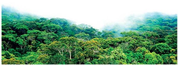
Biologically speaking, the Dellawa Forest Reserve is an integral part of Sinharaja Rain Forest Complex representing the pristine climax forest vegetation of SE wet lowlands and provide a vital connectivity link to adjoining Diyadawa forest of equal significance via the remains of Dombagoda forest. Therefore, clearing a riverine strip of this forest for the construction of Madugeta Reservoir would lead to an irreparable and irreplaceable damage to its characteristic riverine/flood plain forest vegetation.
On the other hand, pledging a reforestation initiative of a much larger area with Hevea rubber as a compensatory measure proposed by the political administration is totally unacceptable. Preserving intact forests in protected areas has no substitutes or replacements. Furthermore, the Natural Heritage Wilderness Area act and the binding articles of the UNESCO Convention on Protection of the World Cultural and Natural Heritage to which Sri Lanka is a signatory, clearly state that causing direct or indirect damage to a natural heritage is legally not permissible.
In summary, the Sinharaja World Heritage Site is already in a state whose biological values are threatened and/or are showing signs of deterioration and significant additional conservation measures have been recommended to restore these values over the medium and long term. Adding more threats like the construction of reservoirs inside protected areas at this stage would inevitably downgrade the values further to a ‘critical conservation outlook’ which is not what the citizenry of Sri Lanka and the world at large would acknowledge as ‘sustainable development’.
The author of this article is a member of the National Sustainable Development Council of Sri Lanka and he thanks Dr Jagath Gunathilaka of Peradeniya University for providing the geotechnical information described herein. The author can be contacted at .)